In the olden days, we relied on physical maps to do everything. There were no maps to help scout hunting lands, private or public. We lived on ink and paper. No longer. While printed maps of hunting properties are still cool, and certainly still viable, these are simply no replacement for apps. Modern hunting apps are very powerful and packed with an array of features.
The first step in being a proficient user of hunting apps is determining how you hunt and what you need. Be introspective. That said, here are the different ways hunting apps can make you a better public-land deer hunter, and a better hunter in general.
Finding Tracts of Public Lands
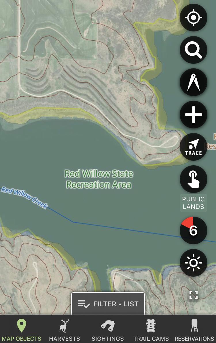
Some hunting apps include layers that highlight properties that are open to the public. This helps hunters in several ways. First, it might help you locate a parcel of land you didn’t realize was open to public access. Secondly, it can help you better learn public lands you already know about. And third, it can help you remain inside the boundary lines once boots are on the ground.

Tapping Unique Data
Some apps have layers with unique data, such as trophy records overlays. This can help identify public lands that are in areas with higher Pope & Young and Boone and Crockett outputs.
Analyzing Properties on Multiple Levels
One of the best features apps have that maps do not is the ability to zoom in and out. Physical maps are fixed. However, you can zoom in and out on apps, which is great for analyzing large swaths of ground, and then diving in deeper to pick apart the spots you like best.
Reading the Terrain
Being able to study the terrain, and see the land features it offers, is crucial. Homing in on edge habitat is a must when trying to find good deer hunting grounds. Apps are perfect for identifying key terrain features, such as crops, CRP, coniferous stands, islands of cover, oxbows, timber harvests, and much more.
Studying Topographic Features
Deer are greatly influenced by topography. The variance in land flow impacts all areas of life, including bedding, feeding, watering, and security. Use these resources to locate important topographic features, such as benches, bottoms, ditches, drainages, draws, flats, hills, hollows, ridges, leeward ridges, marsh interiors, points, pinch points, swamp interiors, waterways, and many others.
Gauging Habitat Maturity
Whitetails prefer early successional habitat. They can’t thrive in expansive stretches of mature timber, even if it’s hardwoods full of mast. They need the bedding cover, security, and browse (food) that younger vegetation offers. Apps can help locate these areas by studying the differences in overhead canopy color. Generally, mature timber will be darker, while younger areas will be lighter.

Locating Bedding, Food and Water
Apps are great for locating bedding areas, food sources, and watering areas. Certain app layers can even show overlays of which trees are oaks (that likely provide food), and which aren’t. Other layers put a focus on finding water sources. Still, others can help identify thicker areas deer use as bedding.
Avoiding Junk Ground
One of the best ways apps improve public land hunting is during the scouting phase. It takes a lot of time to scout vast acreages. Using apps can help you cross off obvious places to avoid. One such area is very homogenous terrain, such as large, unbroken tracts of mature timber. I call such places junk ground. There might be deer there, but the time investment will likely be better spent elsewhere in areas more likely to hold deer, and in areas that are easier to hunt.
Identifying Potential Honey Holes
In contrast, apps are great for finding areas that could potentially produce great results. Being able to mark these, and bounce from one to the next, saves time. Whereas without it, public landers are left to roam more, which isn’t as efficient.
Getting Real-Time Landscape Change Updates
One notable app layer by HuntStand updates the aerial imagery monthly. This is especially beneficial for public land hunters who hunt out of state. Being able to see how properties have changed — such as crop rotations, timber harvests, and other land alterations — helps make good planning and hunting decisions.
Offline Map Versions
Most mapping apps offer the ability to save offline versions of your hunting areas. This is especially important for those who hunt public properties with little to no cellular service. Saving an offline version allows you to use the app even when cell service is non-existent.
Recording Scouting Finds
Most public land hunters spend a lot of time scouting. Apps allow you to mark your discoveries, such as beds, rubs, scrapes, food sources, watering areas, etc. You can take it a step further and walk all the trails in an area with your path tracing feature turned on to record the entire trail network. This really paints a picture of how deer use the property.
Marking Deployed Gear Locations
I have a lot of treestands, blinds, trail cameras, and other gear in the field each season. Marking the exact locations of these helps you remember where everything is located. It’s easy to forget such things.
Navigating the Terrain
Ever got lost in the woods? One of the best benefits of map-based hunting apps is navigation aid. It helps find treestand locations before dawn, and helps you get back to the vehicle after dark. It even helps finding your way during the day.
Keeping Track of Friends
Some apps allow you to help keep track of your hunting buddies. You can share your location with them, reserve stand locations (or other hunting spots), and more. Each of these things makes hunting safer.
Telling Wind Directions
Most apps tell or show the wind direction. This is very beneficial for those hunting whitetails. After all, their primary defense mechanism is their nose.

Predicting Thermals
Likewise, you can also use apps to predict thermal activity. These wind drafts follow general rules. When the air warms up, which generally occurs in the morning, thermals rise. When air columns cool down, which tends to happen at dusk, thermals drop. Thermals can also be impacted by water sources, which are cooler than the surrounding air, effectively pulling your scent down and along the water. Generally, thermals are more pronounced in areas with varying topography, such as hill and mountain country.
Monitoring the Weather
Almost all hunting apps display some level of weather coverage. Hunters know the importance of this, and having that feature right there with everything else you need from an app is a great thing. Overall, there’s no question apps make us better public land hunters. And if nothing else, it makes us more efficient, leading to more and better opportunities.
App Options
Hunters who want the most out of technology will need to select the right app based on the specific needs they have. Many different apps can individually do numerous things. Understanding an app’s strengths and weaknesses is important when choosing the right tool for the job.
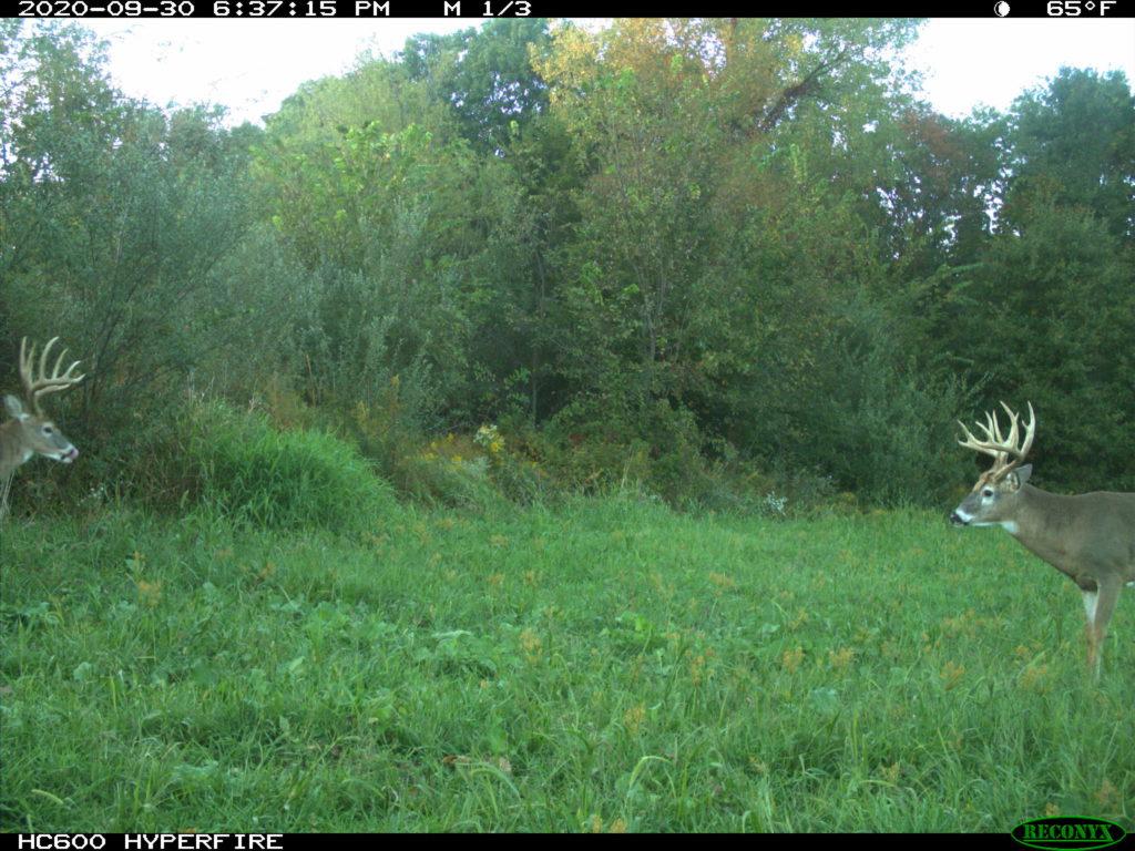
DeerLab: Those who run a lot of trail cameras can certainly benefit from the data analysis capabilities that DeerLab offers to hunters. This takes all the raw data from trail camera photos and produces reports that help you pattern deer.
goHunt: Western hunters who are in the process of picking specific states and units, and who are trying to build points, will benefit from this app. While the app does more than draw odds, point assessments, and unit analysis, it really shines in these departments.
GoWild: Those who love a good social hunting app should consider GoWild. It’s designed for interaction, but also has a significant focus on gear.
HuntStand: As a member of HuntStand’s ambassador team, I spend a lot of time in the app. I know its functionalities and strengths. In my honest opinion, this app is the ultimate option for deer hunters, especially those who own, lease, or otherwise manage hunting land. But it’s also a phenomenal option for public land deer hunters, too.
Red Moon Guide: Those who subscribe to the theory that red moons positively impact deer movement will enjoy having the Red Moon Guide app readily available on their device.
iSolunar Hunting and Fishing App: The iSolunar Hunting & Fishing Times app offers versatility. It offers day ratings, location entry, major and minor feeding patterns, sunrise and sunset, weather predictions, and more.
Shot Simulator: Knowing what shot you made on a deer is very important for determining wait times before following up, what to expect when blood trailing, and more. The Shot Simulator helps with that. It allows you to recreate the impact, effectively showing what vitals were struck, how long to wait, and what to expect while tracking.
SAS Survival Guide: This is one of the ultimate guides to survival, anywhere in the nation. It’s good for all hunters but is especially important for those who chase whitetails alone, and those who hunt deep in the backcountry.
SUNRISE/SUNSET: Knowing the legal shooting time is crucial. Sunrise/Sunset gives you the data you need to stay on the right side of time.

Hot Public-Land Opportunities
Hunters can use hunting apps to locate great hunting spots. Of course, many of these are managed by different agencies and organizations. Study listings in the following categories to find potential public-land hotspots. You can view most of these in apps.
Big Agency Ops: There are numerous national agencies that manage hunting lands open to the public. Some of these include Army Corps of Engineer, Bureau of Land Management, military installations, National Forest Service, and more.
City Lands: Whitetails are oftentimes considered nuisance animals within city limits. Where populations are high, and pockets of suitable habitat exist, deer live in towns and cities. Public hunting programs oftentimes exist in these areas, too.
County Lands: County lands and forests are commonly owned by local governments. These are sometimes open to public hunting.
Walk-In Access: Numerous states have programs that enroll private properties into public access plans. Some of the most notable examples include Indiana, Iowa, Kansas, Michigan, Minnesota, Montana, Nebraska, North Dakota, Oklahoma, Pennsylvania, Virginia, Washington, and Wyoming.
Private Entities: Electric, power, paper, timber, and other large companies hold vast swaths of land. In some instances, they open these grounds to public hunting. Other times, there are trusts with land holdings that also are open to the public.
Hard-to-Reach Ground: Vast public lands that don’t allow motor access require a lot of walking. Hunters rarely move more than a half mile deep, and even fewer go more than a mile. Also, some properties are land-locked or water-locked. The former requires gaining access permission to cross private properties. The latter requires a boat. Both deter other hunters.
Overlooked Parcels: Ugly, neglected, and/or small tracts of public lands sometimes go unhunted. Depending on the scenario, deer can recognize these and flock to such locations. While it takes in-person scouting to confirm this, you can use apps to find potential spots that fit into this category.
Check out more articles like this:


D+DH In-Depth is our premium, comprehensive corner on America’s No. 1 game animal. In this graduate-level course, we’ll teach you about deer biology, behavior, and ultimately, how to become a better hunter. Get articles sent to your inbox each time they go live by signing up here!


